CONSENT APPLICATION NO. D10-11/25 & D10-12/25
THOMAS AND KARA SELBY
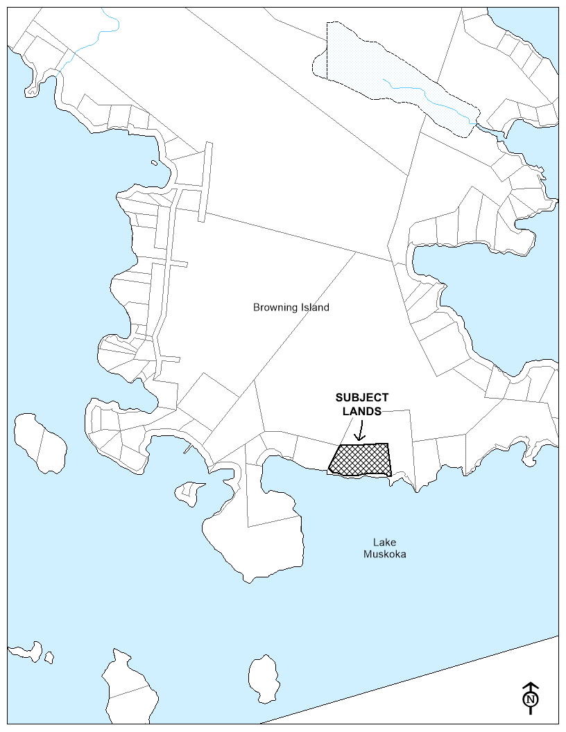
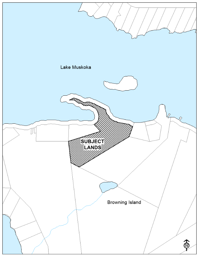
140 BROWNING ISLAND: ROLL NUMBER 4418 020 007 013 00
EXPLANATION OF THE PURPOSE AND EFFECT OF THE CONSENT APPLICATION
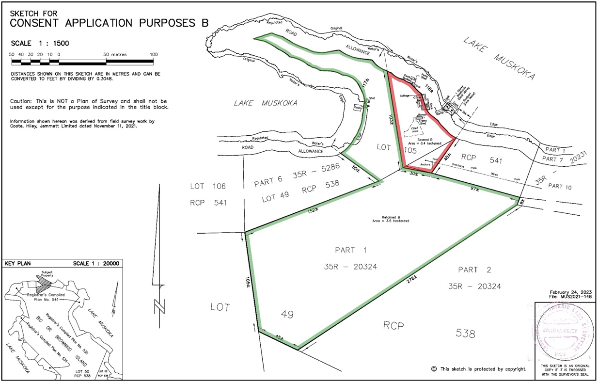
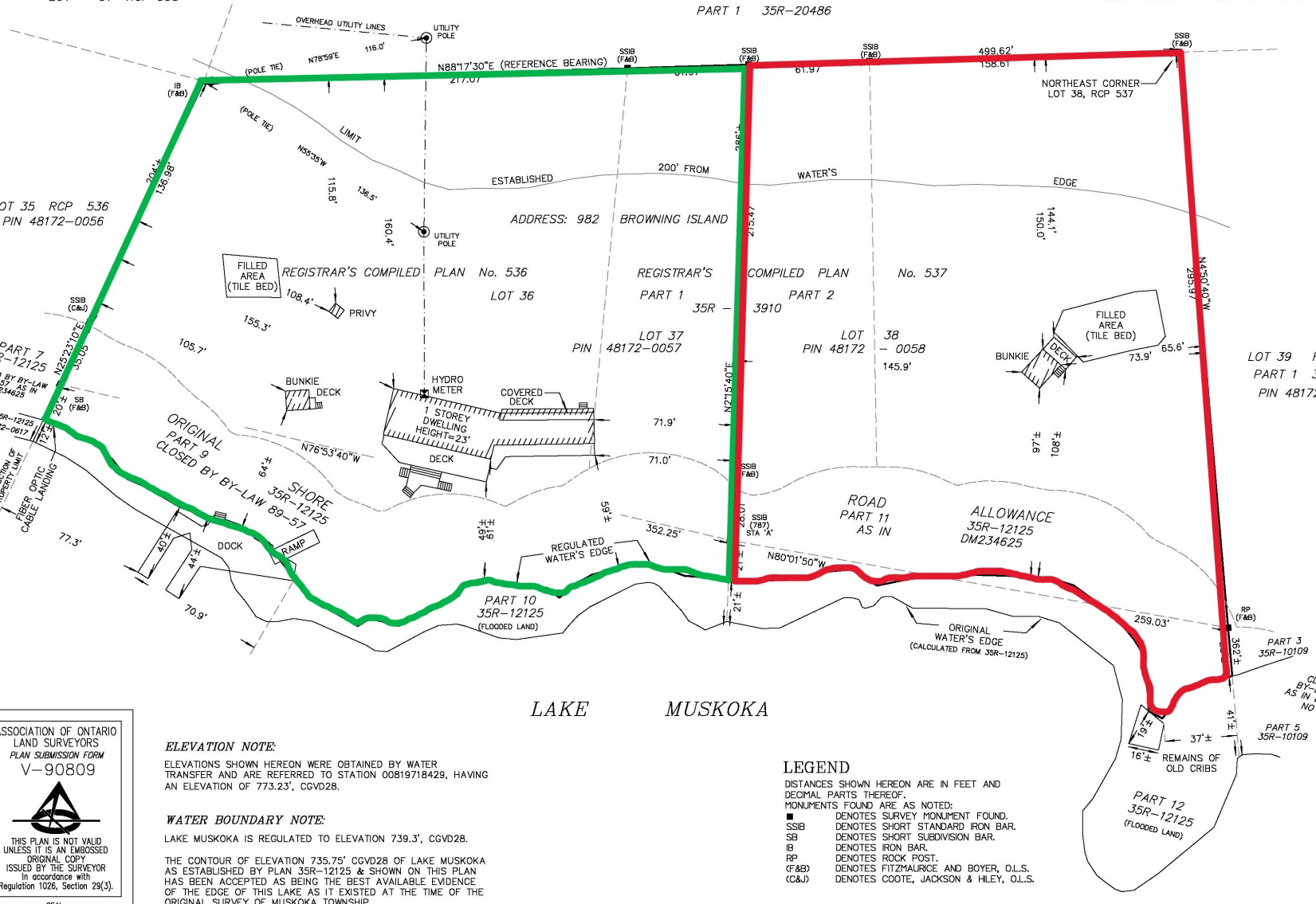
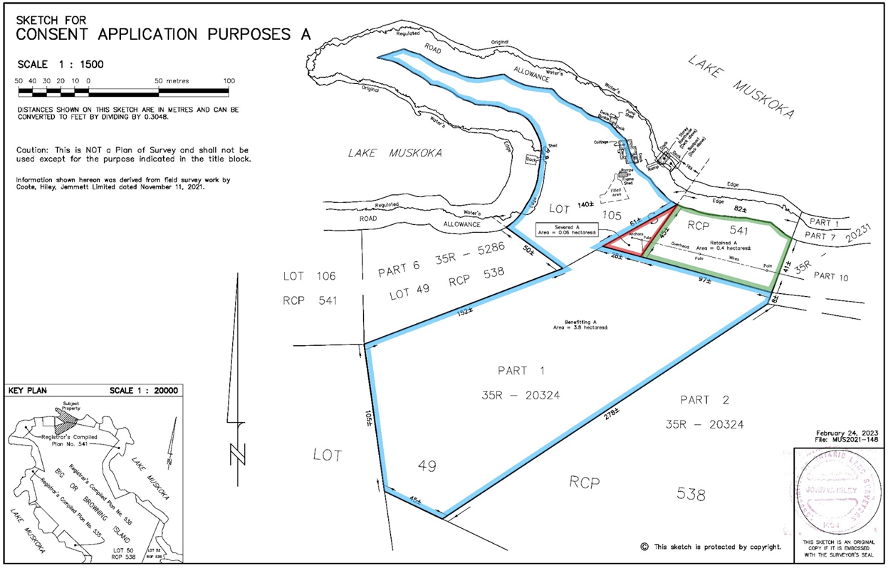
Two (2) applications for consent have been submitted for the lands located at 140 Browning Island and legally described as Lot 105 RCP 541 and part of Lot 49 RCP 538, being part of Big or Browning Island in Lake Muskoka, Muskoka North Ward, Town of Bracebridge including Part 1 of 35R-20324 and Part 6 of 35R-5286. While this property is identified by one civic address and one assessment roll number, it is comprised of three (3) separately conveyable lots. The three properties are comprised of the eastern portion of Lot 105, RCP 541 (Subject Lands from application D10-11/25), the western portion of Lot 105, RCP 541 including Part 1 of 35R-20324 (Subject Lands from application D10-12/25) and Part 6 of 35R-5286, which is not subject to either application. If approved, the applications would result in a lot addition followed by the creation of one severed parcel and one retained parcel.
The subject lands from application D10-11/25 are approximately 0.46 hectares (1.15 acres) in area with approximately 75 metres (246 feet) of frontage on Lake Muskoka. This application proposes to sever a 0.06 hectare (0.15 acre) portion of Lot 105, RCP 541 with no water frontage to be added to the western portion of Lot 105, RCP 541, which currently exists as a separate lot. The retained lot, being on the eastern portion of Lot 105, RCP 541, would have a resultant lot area of 0.4 hectares (1.0 acre) and lot frontage of approximately 82.0 metres (269 feet).
The subject lands from application D10-12/25 are approximately 3.9 hectares (9.6 acres) in area with approximately 140 metres (459 feet) of frontage on Lake Muskoka. This application would result in the creation of a severed lot approximately 0.4 hectares (1.0 acre) in area with approximately 118 metres (387 feet) of frontage on Lake Muskoka. The resultant retained lot would be approximately 3.5 hectares (8.6 acres) in area with approximately 117 metres (384 feet) of frontage on Lake Muskoka.
The Town’s Comprehensive Zoning By-law measures frontage for waterfront lots by extending the side lot lines to the water and measuring the straightline distance between the two points where the side lot lines meet the water. As a result, the frontage of the retained lot in application D10-11/25 is increased as a result in the change of the angle of the side lot line and the combined straightline frontage of the two resulting lots from application D10-12/25 are larger than the frontage of the subject lands.
KEY PLAN
SKETCH "A" FOR D10-11/25
SKETCH "B" FOR D10-12/25