CONSENT APPLICATION NO. D10-39/24 through D10-43/24
1000521311 ONTARIO INC. - ROLL NUMBER 4418 060 017 00100 // 4418 060 017 03600
EXPLANATION OF THE PURPOSE AND EFFECT OF THE CONSENT APPLICATION
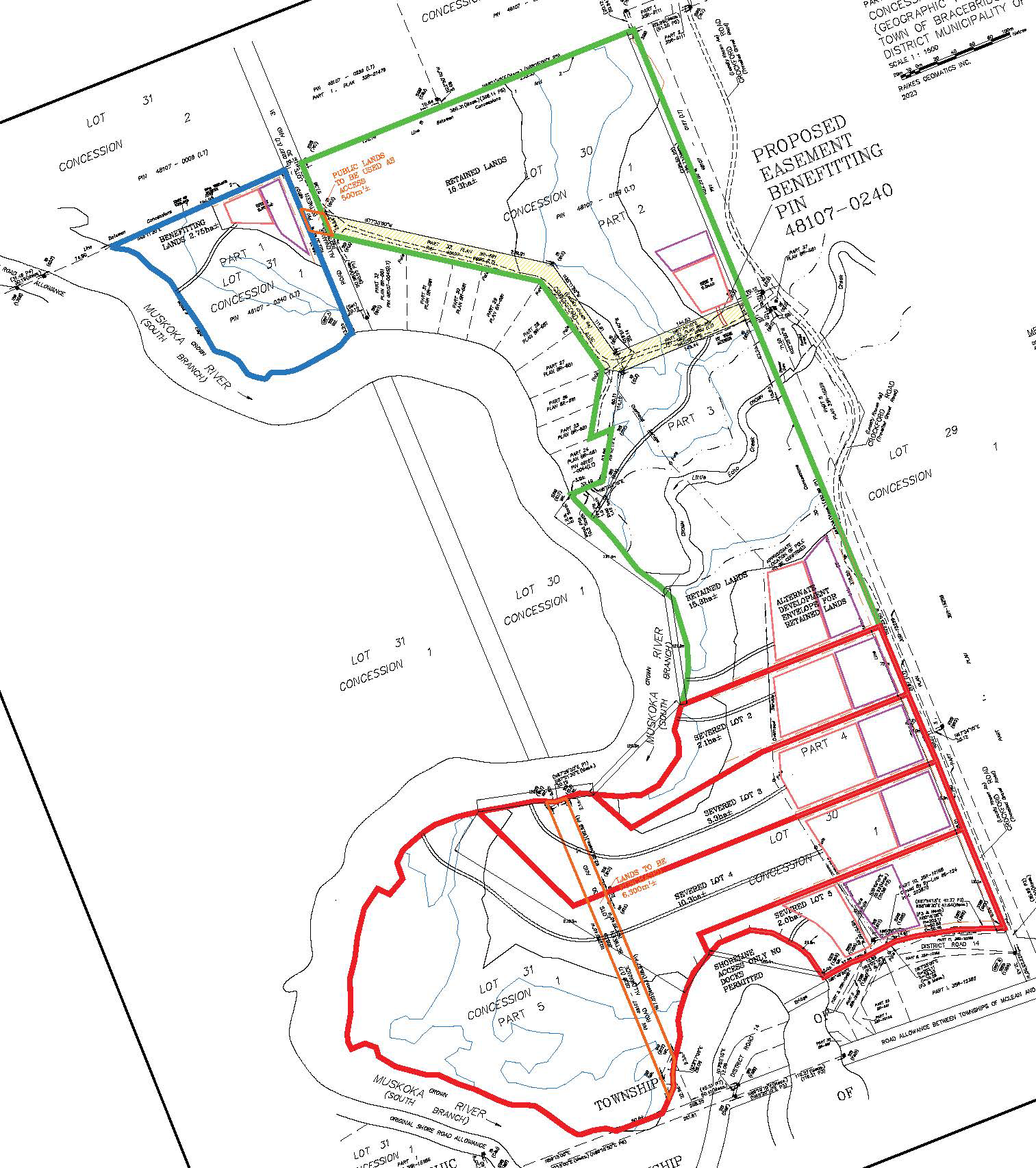
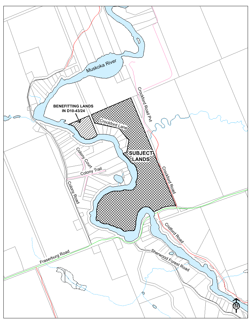
Five (5) applications for consent have been submitted for the lands located at Crockford Road and Crockford Lane, and legally described as part of Lots 30 and 31, Concession 1, McLean Ward, Town of Bracebridge. The subject lands are approximately 33 hectares (81.6 acres) in area with approximately 447.2 metres (1,467 feet) of frontage on Crockford Road, 119.0 metres (390.4 feet) of frontage on Crockford Road Private, 420 metres (1,378 feet) of frontage on Crockford Lane Private, and 891.7 metres (2,956 feet) of total linear frontage on the Muskoka River. If approved, the applications would result in four (4) severed parcels and one retained parcel. Additionally, a 20.12 metre wide right-of-way is proposed over the retained lot, in the location of Crockford Lane, in favour of an existing lot identified on the consent sketch as Benefitting Lands.
|
Application Numbers |
Lot # on sketch |
Proposed Area |
Proposed Frontage |
|
All |
Retained Lot |
15.3 hectares (37.8 acres) includes 1.01 hectares (2.5 acre) proposed right-of-way |
244.8 metres (803.1 feet) on Muskoka River, 119.0 metres (390.4 feet) on Crockford Road Pvt, 112 metres (367.5 feet) on Crockford Road, includes 420 metres (1,378 feet) of frontage on Crockford Lane Pvt |
|
D10-39/24 |
Lot 2 |
2.1 hectares (5.2 acres) |
128.5 metres (421.6 feet) on Muskoka River and 75.1 metres (246.4 feet) on Crockford Road |
|
D10-40/24 |
Lot 3 |
3.3 hectares (8.2 acres) |
120.0 metres (393.7 feet) on Muskoka River and 75.0 metres (246.0 feet) on Crockford Road |
|
D10-41/24 |
Lot 4 |
10.3 hectares (25.5 acres) |
278.3 metres (913.1 feet) on Muskoka River and 75.0 metres (246.0 feet) on Crockford Road |
|
D10-42/24 |
Lot 5 |
2.0 hectares (4.9 acres) |
120.4 metres (395.0 feet) on Muskoka River and 110.1 metres (361.2 feet) on Crockford Road |
|
D10-43/24 |
Benefitting Lands for Right-of-Way |
2.75 hectares (6.8 acres) |
246 metres (807.1 ft) on Muskoka River |
|
D10-43/24 |
Right-Of-Way (Crockford Lane) |
Approx. 1.01 hectares (2.5 acres) |
20.12 metres (66.0 feet) wide |
KEY PLAN
SKETCH